

 (2)1.jpg)

1.jpg "Kennedy Hire")
.jpg "Marler Probate Judge")


.jpeg)


.jpeg "The Plant")

.jpg "Tri State Parking Lot")


1.jpg "Last Call Spirits")


 (1).gif "DMG")


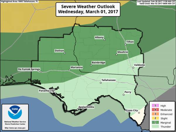
Update on Severe Weather Potential Wednesday Evening
Matt BosterViewed: 3838
Posted by: Matt Boster
Date: Feb 28 2017 6:49 PM
The Storm Prediction Center has kept our region (excluding the Big Bend) in a Marginal Risk for severe weather tomorrow evening. The most likely scenario is that severe weather will remain north of our Georgia and Alabama counties and west of our Florida counties.
However, due to how near strong to severe storms may come to our region, a small threat still exists should the line of storms arrive earlier than currently forecast. Should severe storms reach the Tri-State region, the main threat would be for damaging straight line winds though an isolated tornado could not be ruled out.
Currently, the line of storms is expected to reach our Alabama and Florida counties between 6-9PM CST.

<- back


1.jpeg)


 (2).jpg)
.JPG "Wiregrass Electric")


.jpg "Last Call Spirits")


.jpg "Harley Davidson")


.jpg "Kennedy Hire")
1.jpg "Marler for Probate Judge")


