


.jpeg "The Plant")


1.jpg "Kennedy Hire")


1.jpg "Last Call Spirits")
.jpg "Tri State Parking Lot")


.jpeg)


.jpg "Marler Probate Judge")
 (2)1.jpg)
 (1).gif "DMG")


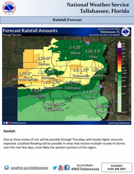
Weather Outlook for this Week in the Wiregrass
Matt BosterViewed: 1577
Posted by: Matt Boster
Date: May 04 2021 12:14 PM
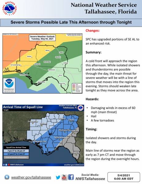
DOTHAN: SPC upgraded portions of southeast Alabama to an enhanced risk and expanded the slight risk east for today/tonight.
Bottom Line:
While showers and thunderstorms will be possible through the day, severe storms will be most likely this evening into tonight as a line of storms moves across the region.
Overview:
A cold front will move across the south today. Scattered showers and thunderstorms will be possible through the day, however the best chance for severe storms will be with a line of storms that moves through the area this evening into tonight.
The greatest threat will be across southeast Alabama and portions of the Florida Panhandle and southwest Georgia. Damaging winds are the primary threat, however, a few tornadoes and hail are also possible.

<- back

.jpg "Last Call Spirits")


1.jpeg)


.JPG "Wiregrass Electric")


.jpg "Kennedy Hire")


1.jpg "Marler for Probate Judge")


.jpg "Harley Davidson")


 (2).jpg)