


1.jpg "Kennedy Hire")
 (2)1.jpg)


.jpeg "The Plant")


.jpeg)


 (1).gif "DMG")


.jpg "Marler Probate Judge")


1.jpg "Last Call Spirits")

.jpg "Tri State Parking Lot")


Wednesday Morning National Weather Service Update
Viewed: 1628
Posted by: RStokes
Date: Apr 10 2024 6:38 AM
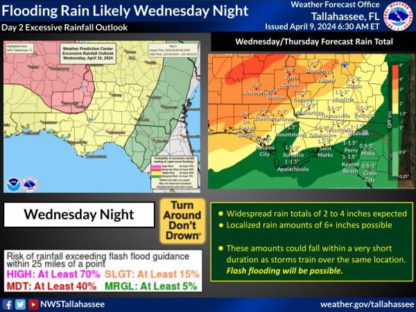
Food watch in effect. 1-4 inches rain is possible tonight.
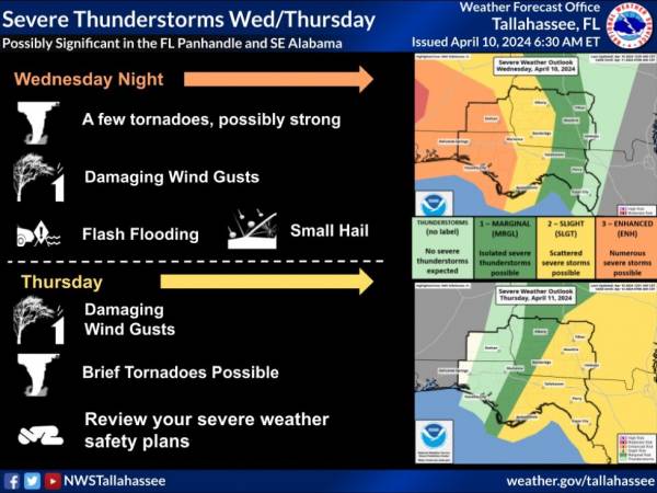
Today: Showers and thunderstorms likely, mainly after 5pm. Some storms could be severe, with heavy rain. Mostly cloudy, with a high near 78. Breezy, with a south southeast wind 5 to 10 mph increasing to 15 to 20 mph in the afternoon. Winds could gust as high as 30 mph. Chance of precipitation is 60%. New rainfall amounts between a quarter and half of an inch possible.
Tonight: Showers and thunderstorms. Some storms could be severe, with heavy rain. Low around 65. Breezy, with a south southeast wind around 20 mph, with gusts as high as 35 mph. Chance of precipitation is 90%. New rainfall amounts between 3 and 4 inches possible.
Some portion of the region is likely to get very heavy rain and possible flash flooding. If you encounter flooding, remember, turn around don’t drown
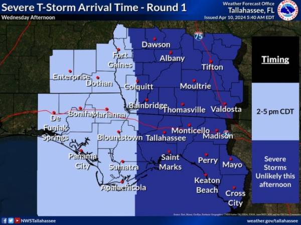
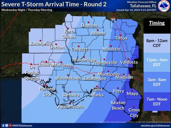
The Florida Panhandle and Southeast Alabama could get two round of severe storms. Here are timing graphics.
Stay weather aware today and tonight. There is an Enhanced Risk (Level 3 of 5) of severe thunderstorms over our Central Time Zone Counties. Storms will move east overnight and Thursday morning into the Eastern Time Zone, where there’s a Slight Risk.

<- back


1.jpg "Marler for Probate Judge")


.jpg "Kennedy Hire")


 (2).jpg)


.JPG "Wiregrass Electric")

1.jpeg)


.jpg "Last Call Spirits")

.jpg "Harley Davidson")


