


1.jpg "Kennedy Hire")


.jpeg "The Plant")


.jpg "Marler Probate Judge")


 (2)1.jpg)
 (1).gif "DMG")


.jpeg)


.jpg "Tri State Parking Lot")


1.jpg "Last Call Spirits")


Isolated Severe Weather and Heavy Rainfall Possible Tuesday through Wednesday Nigh
Matthew BosterViewed: 1307
Posted by: Matthew Boster
Date: Mar 25 2024 8:08 AM
Bottom Line:
Strong to isolated severe thunderstorms are possible Tuesday along with heavy rainfall Tuesday through Wednesday night. In addition, breezy conditions will exist today into Tuesday.
Overview:
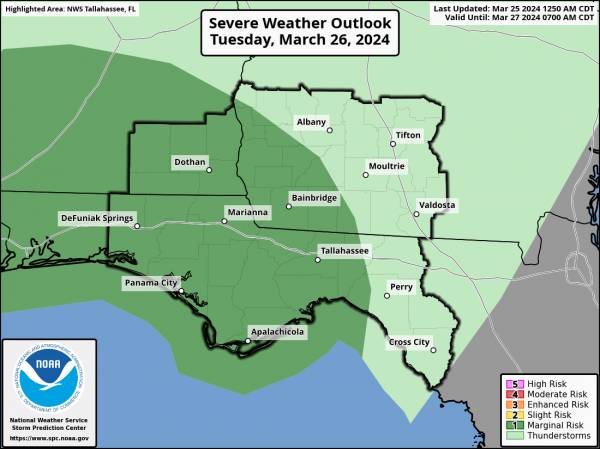
A line of showers and thunderstorms associated with a cold front will enter southeast Alabama and the western Florida panhandle Tuesday morning then slowly progress east through the day. The main threats with this line will be strong to damaging wind gusts and perhaps a brief tornado. The Storm Prediction Center continues a Marginal Risk (1/5) for severe weather in our southeast Alabama and majority of our Florida counties. The line will gradually weaken into the late afternoon and evening hours. The cold front will slow down as it crawls through the area Wednesday and Wednesday night before pushing further east and away from the area Thursday.
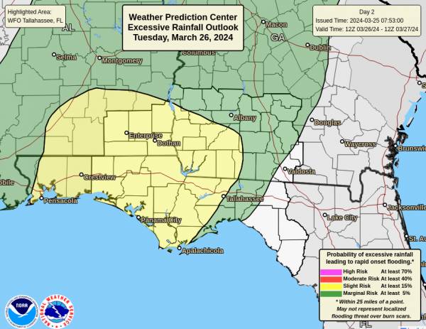
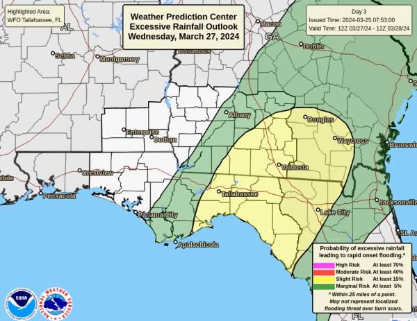
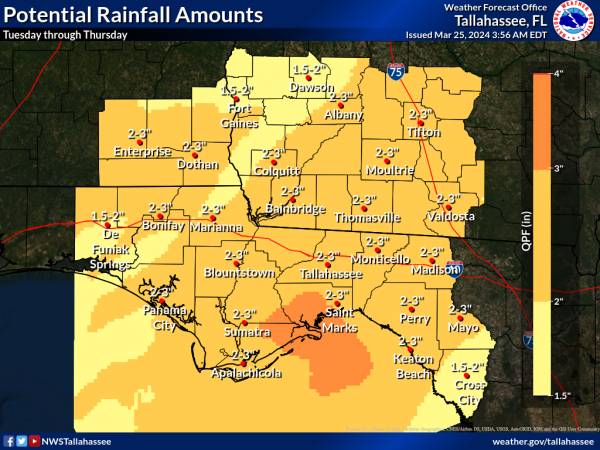
Heavy rainfall is also a growing concern with this system as trends in rainfall amounts have gradually increased over the past few days as we get closer to the event. The cold front is expected to slow down or briefly stall over the area allowing for around a 36 hour window for heavy rainfall before the front moves eastward. Rainfall amounts are on the order of 2-3 inches with isolated higher amounts. The higher end of this range is expected to fall roughly along and east of a Panama City to Albany line. The Weather Prediction Center has a Slight Risk (2/4) for excessive rainfall across much of the area Tuesday and through the Florida Big Bend and adjacent southwest Georgia counties Wednesday.
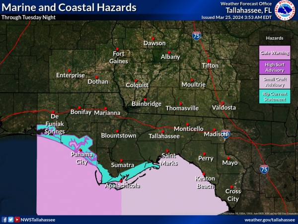
Concerning coastal and marine impacts - A gale warning has been hoisted in waters west of Apalachicola for wind gusts of 35 knots. A small craft advisory remains east of Apalachicola for winds of 20-30 knots. Both of these are in effect through Tuesday morning. A small craft advisory will likely be needed when the gale warning expires to account for higher seas. Dangerous and life threatening rip currents will exist through much of this week along all our local beaches. High surf with heights of 6-7 feet is expected this afternoon and tonight along the Walton and Bay county coasts.
Lastly, breezy conditions will exist today and Tuesday with southeast winds of 15-20 mph with gusts of 30-35 mph.

<- back

.jpg "Last Call Spirits")

.jpg "Harley Davidson")


 (2).jpg)


.JPG "Wiregrass Electric")


1.jpg "Marler for Probate Judge")


.jpg "Kennedy Hire")


1.jpeg)

