


1.jpg "Kennedy Hire")


 (1).gif "DMG")
.jpeg "The Plant")
 (2)1.jpg)


1.jpg "Last Call Spirits")


.jpg "Marler Probate Judge")


.jpg "Tri State Parking Lot")
.jpeg)


Severe Weather Possible Through Evening Hours Friday
Viewed: 1805
Posted by: JRTyson
[email protected]
Date: Mar 17 2023 8:30 AM
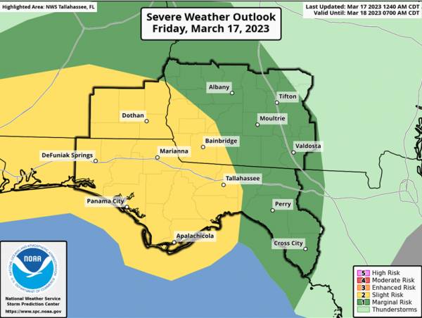
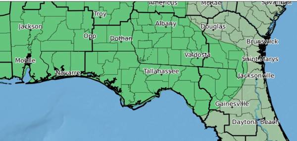
The Slight Risk has expanded even further east and north to include more of the FL panhandle into the Big Bend, SE Alabama, and SW Georgia. The rest of the CWA is included in a Marginal Risk for severe weather. The Day 1 ERO expanded the Marginal Risk to include more of south-central Georgia.
Showers and thunderstorms are expected Friday afternoon through the overnight hours. The SPC has highlighted the Florida Panhandle, west Big Bend, Southeast Alabama, and Southwest Georgia in a Slight Risk for severe weather, with a Marginal Risk across South-central Georgia and the eastern Florida Big Bend. The main threat appears to be damaging wind gusts and a brief tornado or two.
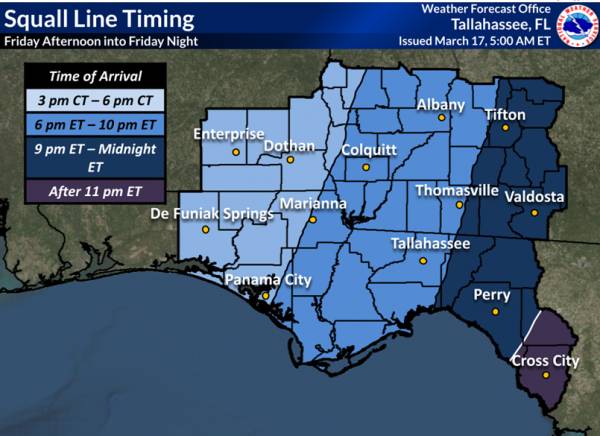
A strong cold front will be making its way through the Gulf Coast states today and tonight accompanied by a line of showers and thunderstorms. Conditions will support strong to severe thunderstorm development with damaging wind gusts being the main threat. However, a couple of tornadoes cannot be ruled out as well. The approximate timing of the line of storms is shown below.
The WPC has also highlighted most of the region in a Marginal (1/4) Risk for Excessive Rainfall. Widespread flooding is not expected with this system, but there could be some localized flooding in low-lying areas Friday into Saturday.

<- back

.jpg "Last Call Spirits")

 (2).jpg)
1.jpeg)


1.jpg "Marler for Probate Judge")

.jpg "Kennedy Hire")
.JPG "Wiregrass Electric")


.jpg "Harley Davidson")


