


.jpg "Tri State Parking Lot")
.jpeg)


1.jpg "Last Call Spirits")


.jpeg "The Plant")


 (2)1.jpg)


 (1).gif "DMG")


.jpg "Marler Probate Judge")


1.jpg "Kennedy Hire")


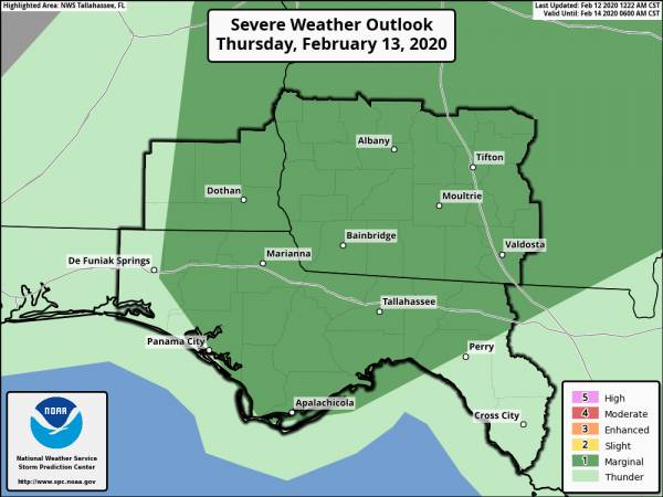
Severe Weather Potential Thursday
Matt BosterViewed: 2309
Posted by: Matt Boster
Date: Feb 12 2020 7:55 AM
Slower arrival places the threat of strong-to-severe storms after sunrise on Thursday for a larger portion of the region. Note that the threat level has not changed, it has just shifted into Thursday for a larger area.
As a cold front moves through the region on Thursday, it will bring a threat for damaging straight-line winds.
A cold front is expected to move into our far western SE AL and Panhandle counties late Wednesday night into early Thursday morning. Due to the lack of instability, expect the line to generally be on a weakening trend during this period of time.
The timing of the front has slowed a bit and it now is forecast to move through the remainder of the region on Thursday morning/afternoon. This will provide a more favorable environment, and we expect the line of storms to re-strengthen. The primary threat will be gusty to damaging straight-line winds.

<- back


 (2).jpg)


1.jpeg)


.jpg "Last Call Spirits")


.JPG "Wiregrass Electric")


1.jpg "Marler for Probate Judge")


.jpg "Harley Davidson")


.jpg "Kennedy Hire")


