


1.jpg "Kennedy Hire")


.jpeg "The Plant")


1.jpg "Last Call Spirits")


 (2)1.jpg)


 (1).gif "DMG")


.jpg "Marler Probate Judge")


.jpeg)


.jpg "Tri State Parking Lot")


Updated at 9:30 AM.. Possible Serve Weather this Weekend
Matt BosterViewed: 2047
Posted by: Matt Boster
Date: Jan 10 2020 8:55 AM
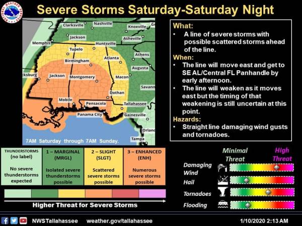
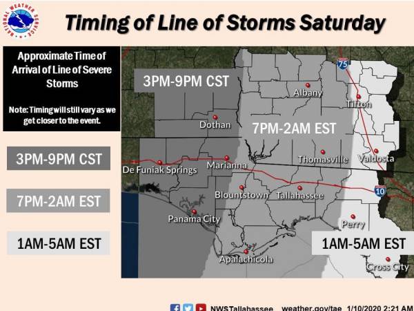
A squall line is forecast to move through the region Saturday evening and overnight. Ahead of the line, scattered severe storm development is possible, with the potential for strong or long-lived tornadoes.
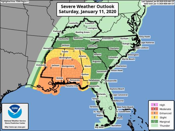
Locations west of the Apalachicola River have been placed under an Enhanced Risk for severe weather on Saturday afternoon/evening. Much of the Enhanced Risk area has the potential for significant severe weather (EF2 tornadoes or stronger).
Elsewhere, damaging winds within the squall line and shorter-lived tornadoes are possible. Flash flooding is unlikely this weekend as the squall line should move quickly through the Tri-State region
Another update will come out shortly and we will update.
UPDATED @ 9:30 AM..
Not much changed in the forecast. Everyone needs to be weather alert this weekend. If something changes we will update again.
UPDATED @ 11:00 AM
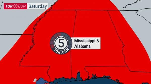
National weather Channel has issued a Torcon 5 for our area this means a Tornado is likely 50% within 50 miles of your location FOR SATURDAY!!!!!! Make plans accordingly

<- back


.jpg "Last Call Spirits")


.JPG "Wiregrass Electric")
.jpg "Kennedy Hire")


.jpg "Harley Davidson")


1.jpg "Marler for Probate Judge")
1.jpeg)


 (2).jpg)